Illustrated Maps

My journey with maps has taken many forms, from architectural school to professional design projects. These days, it’s all about injecting personality, whimsy, and a touch of the unexpected. These illustrated maps blend structure with storytelling, turning places and spaces into playful and characterful worlds far beyond the grid.

A colorful illustrated map depicting various environmental and sustainable energy themes, including wind turbines, solar panels, water sources, rural buildings, and people engaging in outdoor activities and renewable energy projects.

Yorkshire Dales National Park

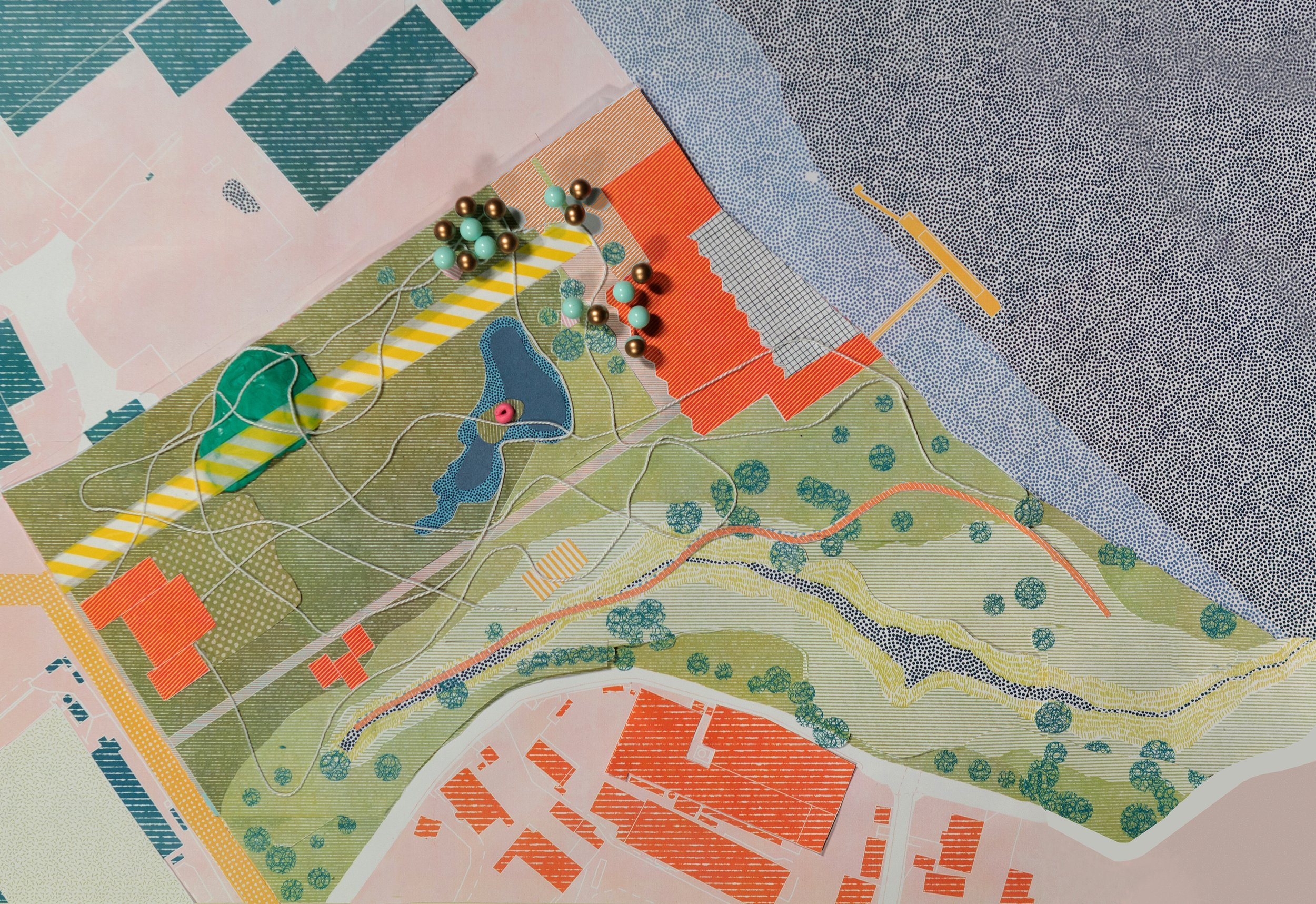
Ebbsfleet Playful City

A detailed map of a city with various color-coded regions, roads, parks, lakes, and buildings outlined for urban planning or navigation.
A colorful abstract map with hexagonal grid pattern, green shaded areas representing parks or forests, and blue sections indicating water bodies. Black dashed line indicates a route crossing through the map.
Detailed map of a park or landscape featuring pathways, small water bodies, trees, and what appears to be a building complex, with colorful markers and a string of beads on top.

Bolton Abbey Estate Maps

Map of a region with colored areas indicating different zones, including a large yellow zone in the southeast with a red line running through it.
A detailed map showing a river winding through green and yellow landscape, with roads, buildings, trees, and contour lines indicating terrain.
Topographic map showing a river running through a valley with various land uses, roads, forested areas, and contour lines indicating elevation.
Line drawing of a city skyline silhouette.

Venice Maps

Map of Venice, Italy, with city streets and canals, highlighted by five gold circles indicating points of interest.
A line drawing of a backyard with a swimming pool, patio furniture, trees, and a staircase leading to the yard.
An aerial illustration of a dense European city with a network of narrow streets, red rooftops, and some green parks interspersed throughout.

Bristol’s Playhouse

A colorful hand-drawn map of Turkey showing landmarks, natural features, and cultural symbols like a castle, trees, tents, wind, and a skull, with a compass rose indicating directions.
A digital illustrated map showing a city with rivers, multiple buildings, roads, parks, and green spaces. The focus is on a waterfront area with a city block outlined in orange.
Cutaway illustration of a theater with a stage, seating, and structural elements.
A city map showing waterways, bridges, roads, and buildings in various shades of brown, yellow, pink, and blue.

Bethnal Green Map

Color-coded map of a city showing streets, parks, buildings, and bodies of water.

Hafod Map

A detailed line drawing of an urban area showing roads, parking lots, buildings, trees, and natural landscape features.